|
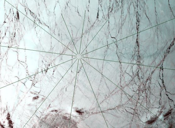
Explanation: Orbiting over the north pole of planet Earth on May 5, the MODIS instrument on-board the Terra spacecraft, recorded this view of the ice cap 700 kilometers below. A radial grid centered on the pole is shown on top of the approximately true color image where each pixel covers about one square kilometer. Frozen sea ice appears whitish while open water or newly refrozen ice looks black. An impressive criss-crossing network of cracks in ice shifting above a liquid water ocean is visible, traced by the meandering dark lines. In fact, the dark network of cracks in the sea ice is reminiscent of another world in our solar system which may also harbor a liquid water ocean -- Jupiter's ice moon Europa.
|
January February March April May June July August September October November December |
| |||||||||||||||||||||||||||||||||||||||||||||||||||||||
NASA Web Site Statements, Warnings, and Disclaimers
NASA Official: Jay Norris. Specific rights apply.
A service of: LHEA at NASA / GSFC
& Michigan Tech. U.
Based on Astronomy Picture
Of the Day
Publications with keywords: Earth - Europa - ice - ocean - north pole
Publications with words: Earth - Europa - ice - ocean - north pole
See also:
- Earthset from Orion
- APOD: 2025 October 12 Á All the Water on Europa
- APOD: 2025 December 8 Á Flying Over the Earth at Night
- APOD: 2025 September 7 Á All the Water on Planet Earth
- APOD: 2025 June 15 Á Two Worlds One Sun
- APOD: 2024 December 29 Á Methane Bubbles Frozen in Lake Baikal
- Interplanetary Earth
